Upanup recognized the importance of creating a welcoming and purposefully built website that aligned with MWRA's values and vision. The new website was designed to be user-friendly, visually engaging, and reflective of MWRA's commitment to transparency, education, and community engagement.
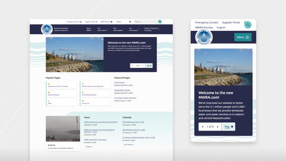
Key improvements included enhanced functionality, such as intuitive, service-based navigation and a robust search feature, enabling visitors to quickly and easily find the information that they need. The updated site also incorporates modern design elements that balance professionalism with approachability, creating a positive, friendly and engaging user experience.
To support MWRA's role as an educational resource, the website includes features specifically tailored to highlight its initiatives. Dedicated sections for public tours, school programs, and community resources help ensure that users can effortlessly access this information, which fosters stronger awareness of MWRA's activities and mission.
In addition, the new website was built on a scalable and user-friendly content management system (CMS), allowing MWRA's team to efficiently update content and adapt as the organization grows. This ensures that the website remains future-ready for the public and MWRA.
Through thoughtful design and development, Upanup delivered a solution that not only meets MWRA's immediate needs, but also positions the organization for continued success in its communication and outreach efforts.
Unique Features
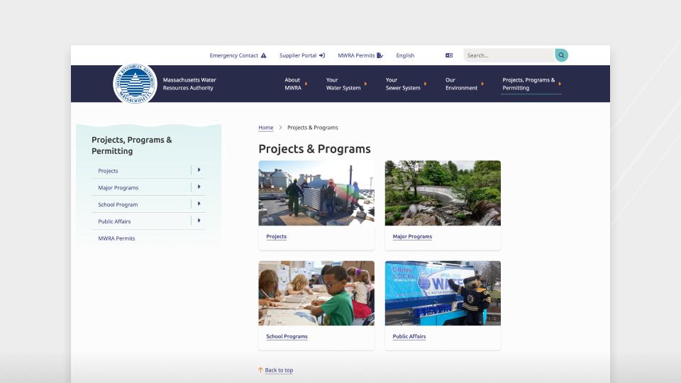
- Thoughtful Site Design - We developed a new, intuitive sitemap that provides users with a seamless navigation experience. This ensures that site visitors can quickly find the pages they need while gaining a better understanding of the website's overall structure. During the design phase, we presented MWRA with 2 custom design options, with a total of 12 distinct views. This approach allowed us to meet MWRA's specific design requirements while also capturing the organization's unique branding and visual identity.
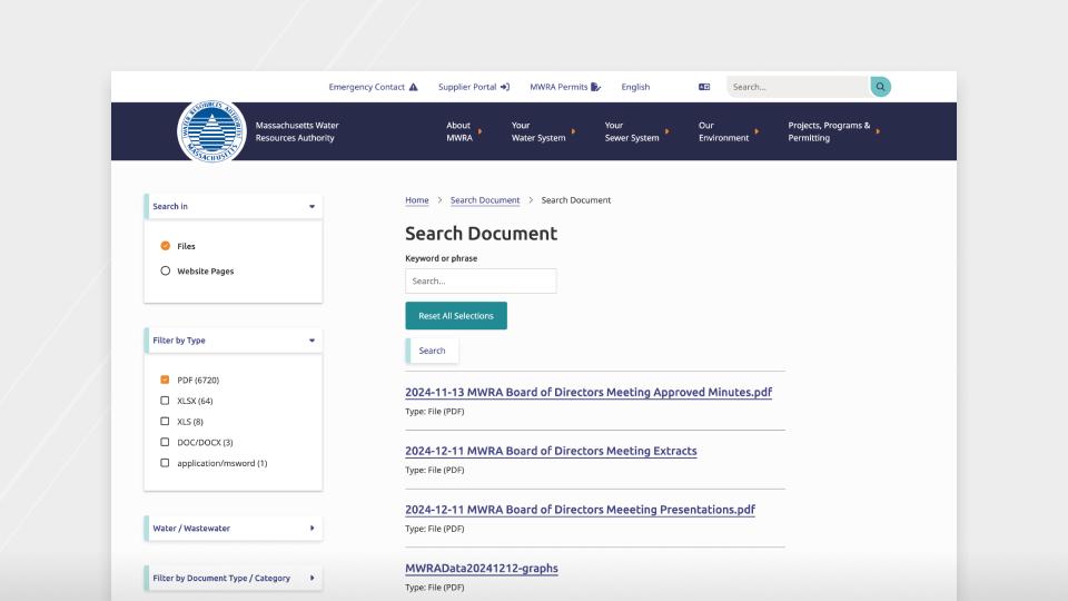
- Custom Search Functionality & Filtering - To enhance the user-experience (UX) and streamline the process of searching for information, our team implemented a customized unique search function tailored to MWRA's needs. This feature operates much like a 'shopping cart', efficiently pulling up relevant pages and files based on user choices. To further improve accessibility, we incorporated multiple custom filtering fields enabling users to refine their searches and locate information quickly.
Upanup provided MWRA spreadsheets where MWRA inputted categories for each existing file and page on the site, including PDF, MS Word, MS Excel and HTML documents. This spreadsheet was then used to upload new category data to ensure everything was searchable and filterable as desired by MWRA. - Live Quab Cam - As per MWRA's request, we incorporated a live Quabcam on the bottom-left of the homepage, offering site visitors a real-time view of the Quabbin Reservoir. This unique additional creates a direct connection between users and MWRA's environment-focused mission.
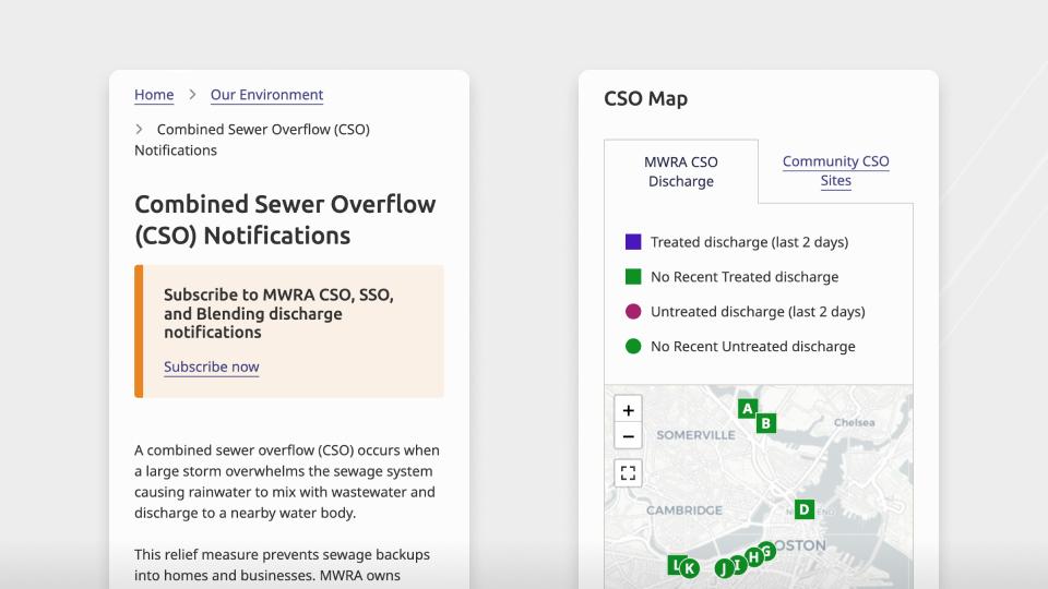
- - providing users with a clear and accessible visual representation of sewer overflow notifications. These maps are a critical tool for promoting public awareness and transparency, aligning with MWRA's commitment to providing accessible information to the public. The information displayed on these maps is reported daily to the Department of Environmental Protection, making accuracy and real-time updates essential. Our implementation ensures that the data is reliably displayed and easy for users to interpret, empowering communities with up-to-date information on sewer overflow activity.
For the maps to be updated per regulatory standards, Upanup trained MWRA staff and provided specific users with access to the feed importer in the back end to upload sheets of data. The Excel files included information such as latitude and longitude values, start and stop time of the outflow, volume and rainfall amounts, which programmatically feed into the maps shown. These maps are not only a resource for public engagement but also a vital component of MWRA's regulatory compliance and communication efforts.